One of HERE Technologies' central products is a high definition map for self-driving cars. To gather data for creating these maps, collection cars with GPS, cameras and a LiDAR system are deployed wherever new or more data is needed. I worked on a fleet management system and the driver's app for the data capture vehicles.
Role: user experience and visual design
2016 - 2020

Drafts for Cyclops, an app to capture data for map creation
Fleetvision
Fleetvision is a web application for end-to-end data collection orchestration and monitoring. Managers and fleet support need to track drivers, check the status of collection rigs, and control the billing by hourly paid drivers. With the app, users can monitor the status of routes, cars, and collected data.


Valence
Drivers of the collection vehicles need to get clear guidance but also have access to the status of the rig and get warned if anything is not working properly. Safety concerns for the drivers were the core of the design of the app. The challenge was to design an experience that is not distracting while driving but also serves all needs of the data collection.


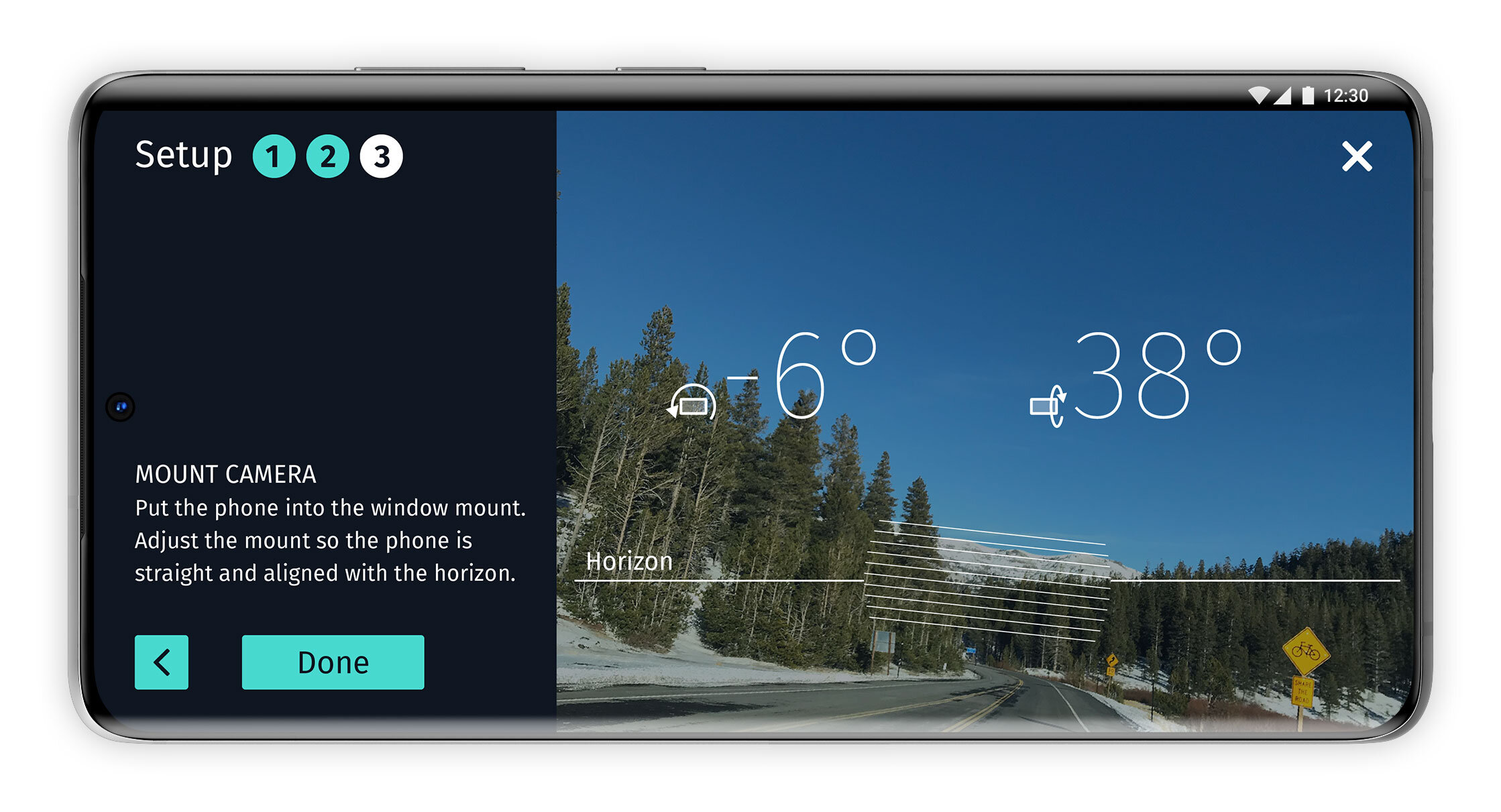
Cyclops
This app allows for the collection of data without the main rig. It uses the phone camera and sensors, but for higher precision, it also uses an external GPS antenna. Setting up the antenna and calibrating the phone requires more effort from the user, so the main focus of the design was a guided setup.