
Map Production Tools
To create a map product HERE Technologie uses machine learning algorithms to extract signs, lanes and other map objects from the collected data. I was working with a team of globally distributed product managers, designers, and engineers on internal tools to support this effort.
Role: user experience and visual design
2018 - 2020

At the start of the tool build-out, the team needed to have a good understanding of the pipeline, stakeholders, and requirements.
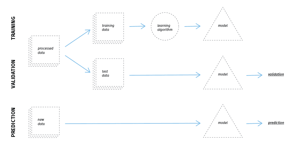
The tools are mainly used to create training data for the object detectors, but also to validate the algorithm.
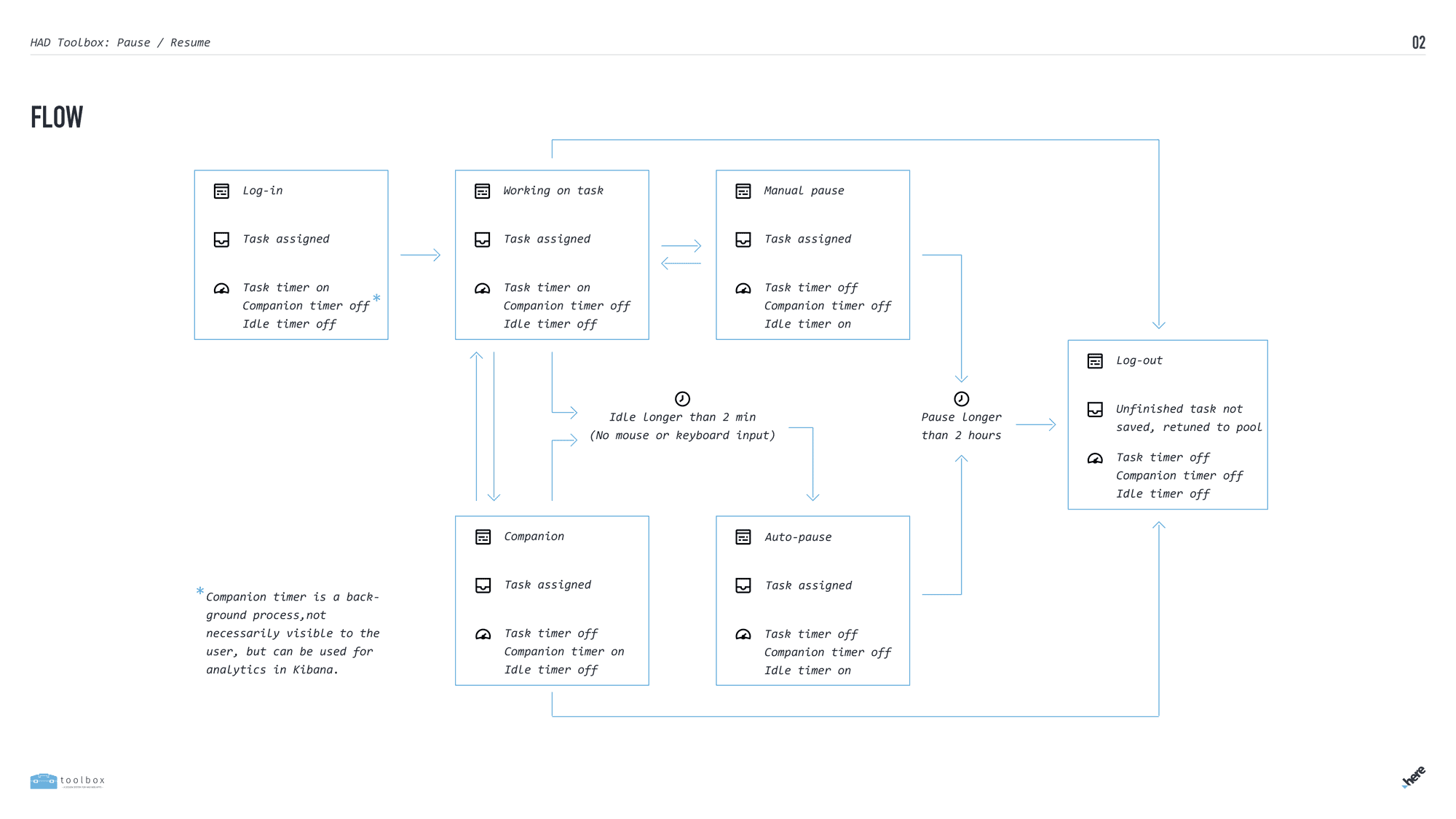
We not only designed the tools but also looked into the workflow of map coders and tried to find inefficiencies and generally improve the workflow.
The work of the coders is very metrics-driven, they have to code a certain number of objects per hour. This is not always easy because there can be ambiguities on how to code real-world objects and the different density of objects in cities and on highways.
We had to design a lot of different tools for changing requirements, like different map objects (signs, lanes, etc.) or different input data (satellite, LiDAR, street imagery).
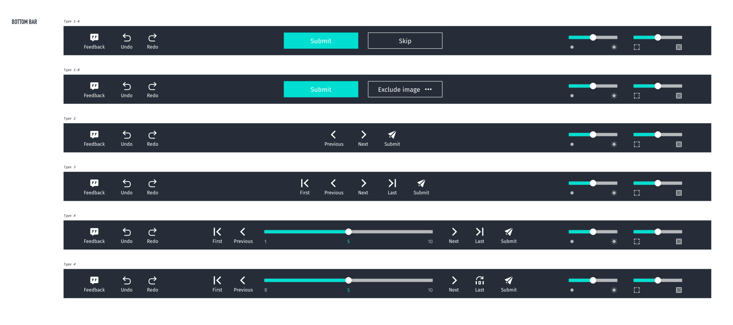
To streamline this we came up with a design and component system to which I actively contributed. The toolbars above allowed the user to move from image to image or task to task depending on the requirements of the tool.

Specification for different mouse cursors used in the tools
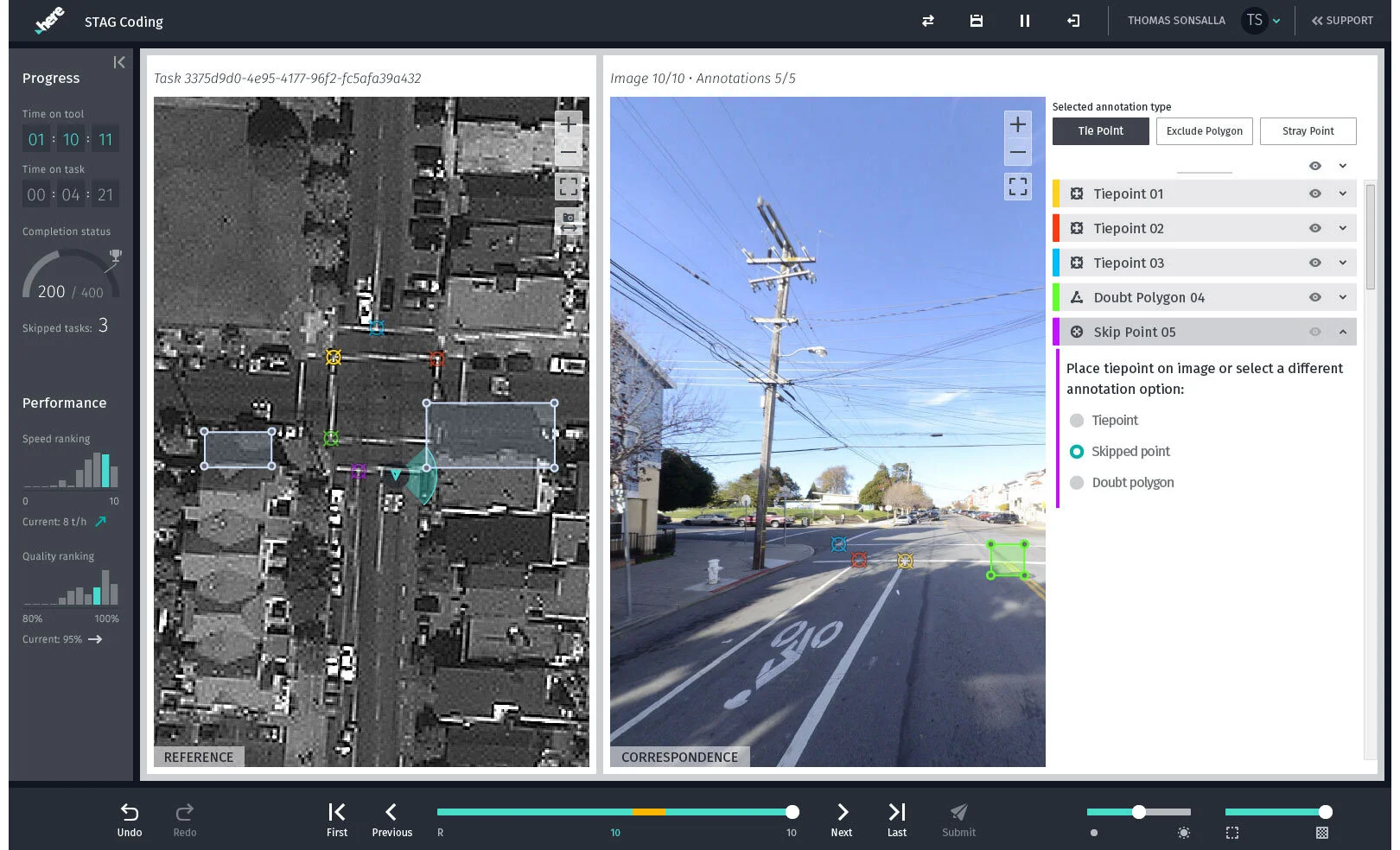


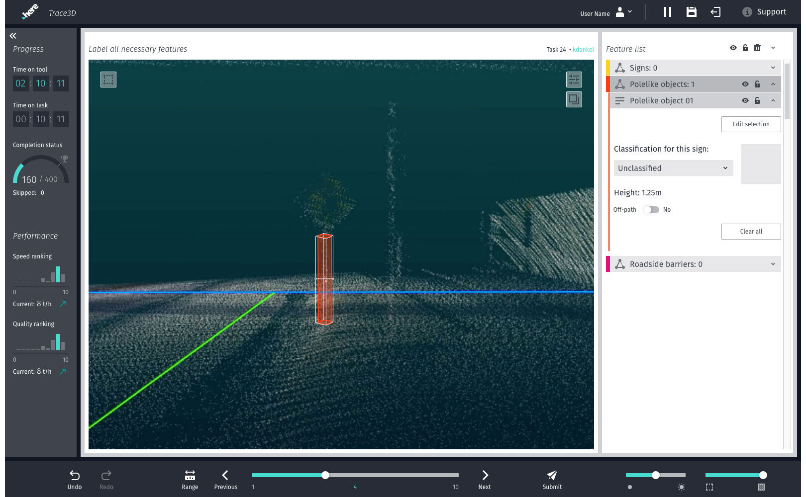
Some screenshots of various tools
![IMG_2271[2].jpg](https://images.squarespace-cdn.com/content/v1/5e48c816d218a94af2a884ad/1582424530235-2NFQ9W9LRVDFZQ2C4YLS/IMG_2271%5B2%5D.jpg)
We had the fortune to have user researchers in Mumbai who could give us feedback on user behavior and tool usability. We also had the opportunity to travel to Mumbai to speak to some coders as well as just being in the same office and observing how they use the tools. We could gather a lot of useful insights.
